

Harish חריש
A new, fast-growing city in the Alexander hills, built from scratch since the 2010s.
Overview
Harish began as a Nahal outpost in 1982, became a kibbutz in 1985 and was disbanded in 1993. It is now being built as a planned city, which Wikipedia says is projected to reach 100,000 residents. It had 41,574 residents in 2024 and was declared a city on 24 May 2022.
It lies east of Route 6, near the Iron Interchange, with a bus terminal that opened in 2024. A railway station on the Menashe line is planned.
- 41,574 (2024)
- Population
- Not on the 2026 list
- Tax credit (2026)
Living in Harish
Quality of life
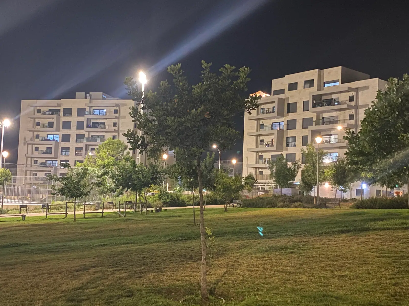
- Mostly new apartment neighborhoods, with parks and a commercial center.
- Route 6 and the Border Guard Interchange (opened February 2022) put Hadera and the Sharon within reach.
- A planned railway station on the Menashe line.
Community
- A mix: in the 2022 census, Hebrew Wikipedia gives 42.7% of households as secular, 22.5% national-religious, 19.1% traditional and 11.7% Haredi.
- A Jewish Link article from August 2024 describes a growing English-speaking community and a family that chose Harish for its walkable layout.
Value for money
- Not on the 2026 list for the locality tax credit.
Good to know
- The town is still being built, so streets, schools and shops are still arriving. Hebrew Wikipedia says about two-thirds of residents work outside the town (2022 census).
- The Haredi share of the population grew from 9% in 2010 to 27% in 2023, according to Hebrew Wikipedia.
- Hebrew Wikipedia gives the town a socio-economic cluster score of 5 of 10 (2021).
Community
- A mix: in the 2022 census, Hebrew Wikipedia gives 42.7% of households as secular, 22.5% national-religious, 19.1% traditional and 11.7% Haredi.
- A Jewish Link article from August 2024 describes a growing English-speaking community and a family that chose Harish for its walkable layout.
Religious life
Women’s mikveh (available in town)
Neighborhoods to know
- HaMagaf
- Or HaMizrach
- Ma’oof
- Shchunat HaPrachim (Neighborhood of Flowers)
Schools
Schools and English-speaking support are being researched and will be added here, each with its source.
Getting around
Harish has no railway station of its own. The station that serves it is Caesarea–Pardes Hanna, about 18 min (15 km) away by road. 36 trains a day run direct to Tel Aviv Savidor Central, in about 43 min.
About 18 bus lines stop in Harish on a weekday. Direct services from Harish include:
- Haifa: 14 direct trips on a weekday (lines 631), from about 43 min; Kavim.
- Tel Aviv: 18 direct trips on a weekday (lines 632, 634), from about 1 h; Kavim.
- Jerusalem: 9 direct trips on a weekday (lines 942), from about 1 h 14 min; Egged.
- Yokneam Illit: 14 direct trips on a weekday (lines 631), from about 24 min; Kavim.
Times are from the first stop in town to the first stop in the destination city. Timetables change, so check the operator’s app before you plan a trip.
By road, Harish is about 43 min (52 km) from Haifa, 53 min (69 km) from Tel Aviv, 1 h 23 min (108 km) from Jerusalem and 55 min (70 km) from Ben Gurion Airport, the nearest international airport. These are free-road estimates with no traffic, so allow more at rush hour.
Sources: Ministry of Transport timetable · OpenStreetMap routing · Wikipedia, Israel Railways
Harish is part of MidNorth Coast, with Haifa, Zichron Yaakov, Caesarea, Hadera and Pardes Hanna-Karkur close by.
Nature & attractions
In half an hour or less you can be at Caesarea National Park (24 min), Ramat HaNadiv (27 min) and Tel Megiddo National Park (28 min). Up to 45 minutes takes you to Bet She’arim National Park (35 min), Nahal Me’arot Nature Reserve (42 min) and Harod Spring (Ma’ayan Harod) National Park (43 min). For a longer day out, Zippori National Park (54 min) and Bet She’an National Park (58 min) are within the hour.
All 8 parks and reserves within an hour, with drive times
- Caesarea National Park · about 24 min by roadThe Roman port city Herod the Great built from about 22 BCE, with a theatre that still hosts concerts, a hippodrome, Crusader walls and aqueducts on the beach.
- Ramat HaNadiv · about 27 min by roadA nature park and garden at the southern end of the Carmel, with pine and cypress groves around the tomb of Baron Edmond de Rothschild and his wife.
- Tel Megiddo National Park · about 28 min by roadThe palaces, temples, gates and water system of a major Canaanite city, part of the UNESCO World Heritage biblical tells. INPA, Tel Megiddo
- Bet She’arim National Park · about 35 min by roadA burial ground where Rabbi Yehuda HaNasi is buried, with the decorated Menorah Caves. INPA, Bet She’arim
- Nahal Me’arot Nature Reserve · about 42 min by roadFour prehistoric caves (Tabun, Jamal, El-Wad and Skhul) with remains of about 500,000 years of human life, a UNESCO World Heritage Site since 2012. INPA, Nahal Me’arot
- Harod Spring (Ma’ayan Harod) National Park · about 43 min by roadA spring from a cave on the slope of Mount Gilboa, a clear brook and a paddling pool, and the Hankin House museum. INPA, Harod Spring
- Zippori National Park · about 54 min by roadA former capital of the Galilee and seat of the Sanhedrin, with Roman and Byzantine mosaics. INPA, Zippori
- Bet She’an National Park · about 58 min by roadThe Roman and Byzantine city, with its theater, bathhouse and streets, below the mound of the biblical city. INPA, Bet She’an
Drive times are free-road estimates from the center of Harish (OpenStreetMap routing). Hours, fees and booking rules change; check the Israel Nature and Parks Authority before you go.
Homes in Harish
Tell us what you’re after and we’ll look in Harish for you. Many homes never reach the big listing sites.
Gallery
Sources
Researched by DreamNorth, checked 18 Oct 2026. Developer and promotional material is marked as such; confirm details before you buy.
- Wikipedia, Harish, Israel
- Hebrew Wikipedia, חריש (עיר) (Harish)
- The Jewish Link, “A Highland Park family’s journey to Harish” (8 Aug 2024)
- Locality income-tax credits: third-party compilation (relotax, GitHub, updated 2 Aug 2026) of the Israel Tax Authority 2026 deductions booklet
- Ministry of Transport, open public-transport timetable (GTFS), feed valid 28 Oct to 26 Nov 2026; weekday counts are for a typical Sunday in that feed (1 Nov 2026), worked out by DreamNorth
- OpenStreetMap routing (OSRM public server, car, no live traffic), drive times and distances worked out by DreamNorth
- Wikipedia, Israel Railways (lines and stations)
- Wikipedia, Caesarea Maritima
- Wikipedia, Ramat HaNadiv
- Israel Nature and Parks Authority, Tel Megiddo National Park
- Israel Nature and Parks Authority, Bet She’arim National Park
- Israel Nature and Parks Authority, Nahal Me’arot Nature Reserve
- Israel Nature and Parks Authority, Harod Spring National Park
- Israel Tax Authority, nadlan.gov.il: reported real-estate transactions